 |
 |
 |
|
Adelaide, Australia. Latitude 34° 56' South, longitude 138° 36' East
| Day | Date | Civil Twilight | Sunrise Time | Sunrise Azimuth | Daylight Hours | Sunset Time | Sunset Azimuth | Civil Twilight | Moon Phase |
| Mon | 11/2/02 | 06:17* | 06:44* | 100° | 13:30 | 20:14* | 244° | 20:41* | |
| Tue | 12/2/02 | 06:19* | 06:45* | 99° | 13:28 | 20:13* | 244° | 20:39* | |
| Wed | 13/2/02 | 06:20* | 06:46* | 99° | 13:26 | 20:12* | 245° | 20:38* | |
| Thu | 14/2/02 | 06:21* | 06:47* | 98° | 13:24 | 20:11* | 245° | 20:37* | |
| Fri | 15/2/02 | 06:22* | 06:48* | 98° | 13:22 | 20:10* | 245° | 20:36* | |
| Sat | 16/2/02 | 06:23* | 06:49* | 97° | 13:20 | 20:09* | 246° | 20:35* | |
| Sun | 17/2/02 | 06:24* | 06:50* | 97° | 13:17 | 20:07* | 246° | 20:34* |
Magnetic declination is 8° East.. Compass readings are Magnetic North - the calculations include the Declination (do not adjust your compass). (Click here for an explanation of declination.) Civil Twilight is defined as the time when the sun is 6° below the horizon. Times followed by an asterisk are Daylight Saving Hours.
These figures assume a nautical horizon;
if the horizon is obscured by mountains or buildings, use the location diagram below to estimate the azimuth (compass bearing) of rising/setting.
If your application requires a high degree of accuracy, it is recommended that you use these figures merely as a guidleine for your own observations.
Click here for additional notes and explanations.
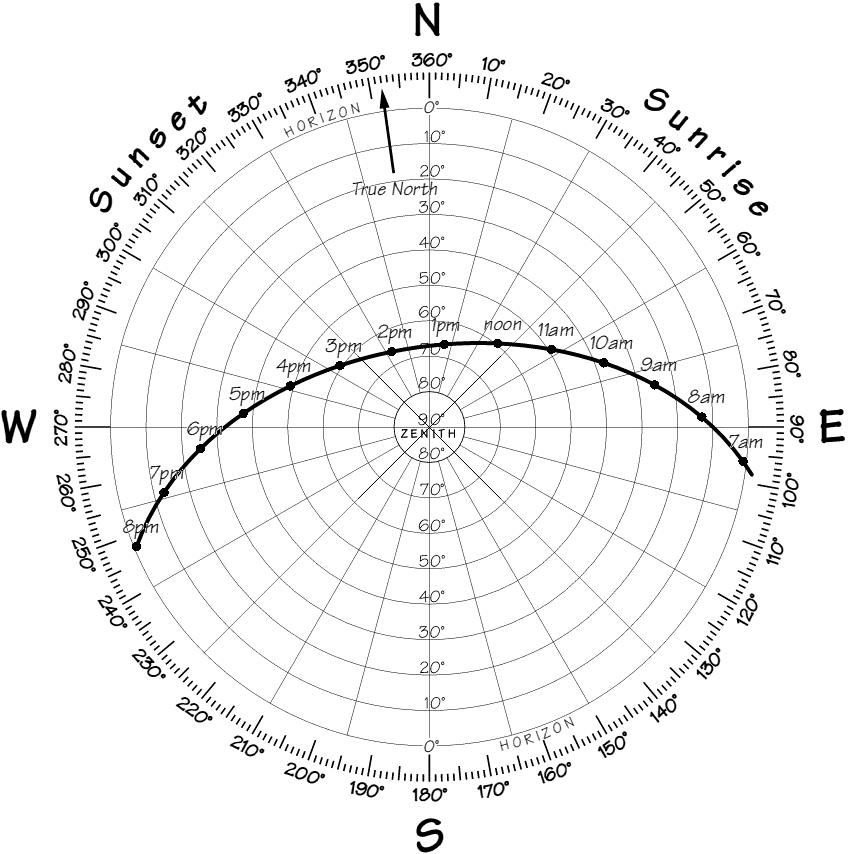
Solar Location Diagram
|
This diagram shows the altitude and azimuth of the Sun from sunrise to sunset. The radial lines indicate the azimuth (compass bearing) at 15° intervals. The concentric circles indicate the altitude of the Sun at 10° intervals, from 0° on the horizon to 90° on the zenith.
Adelaide, Australia.
© Location Works Ltd 2002 |
|